- Who we are
Welcome to VAYUZ Technologies We are an AI-inclusive digital engineering organisation built to help enterprises and high-growth businesses turn complexity into competitive advantage. Across AI, cloud, product engineering, and platform development, we embed intelligence at every layer — not as a feature, but as a foundation. We don't just deliver technology; we engineer the outcomes behind it. Trusted by ambitious brands globally, we operate where precision meets scale.
Welcome to VAYUZ Technologies As we mark a transformative decade at VAYUZ, we are deeply grateful to our resilient team, valued clients, and trusted partners who made this journey possible. We’ve grown into a trusted force in Digital Engineering, Product Engineering, DXD, and RAPYD Talent Solutions, driven by a strong product-centric DNA. Proudly AI-Inclusive, we embed intelligence thoughtfully, with Pragyan AI guiding this evolution. Our Bitovn Suite has advanced into AI-powered solutions—Bitovn Social as an Enterprise Social Intranet and Bitovn Bridge as a dynamic ecosystem. As we step into the next decade, we remain committed to connecting the digital dots, with AI as a powerful ally.
Our Journey VAYUZ was built through a consistent pattern: accepting difficult engineering challenges, delivering with precision, and earning the trust that compounds into long-term partnerships. From our first client engagement to our current position as an AI-inclusive digital engineering organisation, every milestone on our journey represents a standard we raised — for our clients, our teams, and our own expectations of what excellent looks like.
Purpose & Values Our purpose is to engineer the digital infrastructure of ambitious organisations — with the intelligence, rigour, and accountability that lasting competitive advantage demands. We operate by five principles: engineering integrity, outcome orientation, intelligence by design, partnership over vendor relationships, and compound growth. These are not values displayed on a wall — they are decision filters applied daily, at every level of the organisation.
Our Creation Cycle The VAYUZ Creation Cycle is our six-stage operating framework: Discover, Define, Design, Develop, Deploy, Evolve. It translates business ambition into deployed, scalable technology — with discipline at every stage and accountability built into the structure. The cycle eliminates the ambiguity that causes most digital programmes to overrun, under-deliver, or produce systems that require costly rebuilding within eighteen months of their original launch date.
Our Hourcrux In the VAYUZ model, a Hourcrux is a core capability discipline — an area of engineering depth built through deliberate practice, refined through real client delivery, and maintained to a centre-of-excellence standard. Our Hourcruxes are not service categories; they are proprietary capability clusters where our knowledge, tooling, and talent give clients a structural advantage over alternatives who operate at surface depth.
Our SBU's VAYUZ is organised into Strategic Business Units — each built to deliver deep capability in a focused domain, while operating within a shared engineering culture and quality standard. This structure gives clients the expertise of a specialist firm and the breadth of a full-service partner. Each SBU has dedicated leadership, specialist talent, and a defined delivery model — accountability concentrated, never diluted.
- What we do
Overview Over the last decade, VAYUZ has established itself as a
trusted partner in Digital Engineering, Product Engineering, Digital Experience Design (DXD), and RAPYD Talent Solutions. What sets us apart is ourproduct-centric DNA—a mindset that has made us moreagile, adaptive, and innovativewith every project and every partnership. We are not anAI-Firstorganization. Instead, we are proudlyAI-Inclusive, embedding AI thoughtfully into everything we do.Featured

About us
Our Services Our services are structured around outcomes, not technology stacks. From AI system design and cloud-native architecture to full-cycle product engineering and platform modernisation — every capability we offer is built to move a specific business metric. We go deep where depth is required, and we integrate across disciplines where integration creates the most value. Technology without business purpose is just infrastructure.
Featured
About us
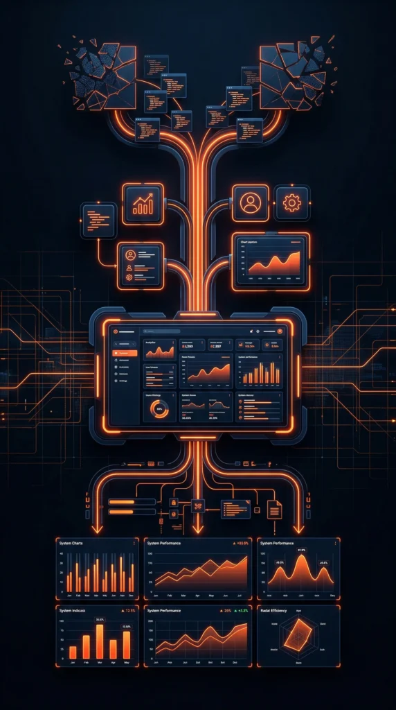
PRAGYAN AI (PAi) Pragyan AI is VAYUZ's enterprise-grade AI platform — purpose-built to operationalise intelligence across business functions. Unlike generic AI wrappers, Pragyan is engineered for production: adaptive, context-aware, and designed for the regulatory and operational demands of complex organisations. It powers intelligent automation, decision support, and agentic workflows — turning data assets into business-grade intelligence systems that compound in value over time.
Featured
About us
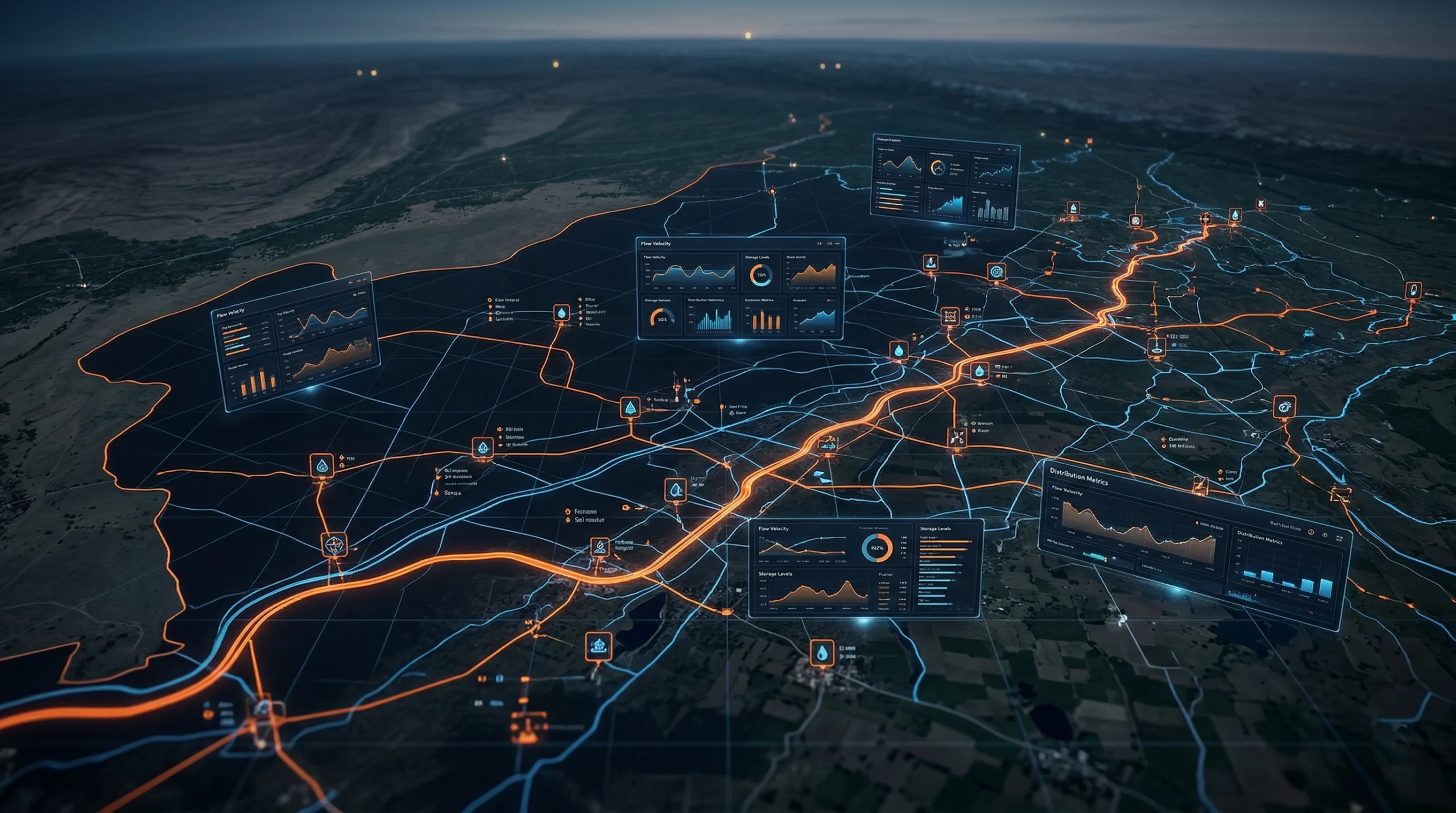
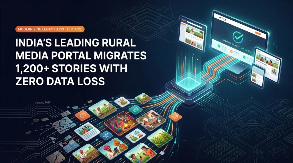
Case Studies Every engagement we take on has one measure: the business outcome it creates. Our case studies document the challenges, decisions, and measurable results across the enterprises and high-growth companies we have partnered with — across AI deployment, cloud transformation, and product development. The work speaks with specificity: not what we built, but what it changed for the organisations that trusted us to build it.
Featured
About us
- What we think
Welcome to VAYUZ Technologies The organisations leading digital transformation are developing better mental models — not just better systems. VAYUZ publishes original thinking from the engineers, architects, and product leaders who are actively solving the problems they write about. No analyst commentary. No recycled frameworks. What we share here is built from real engagements, honest about what works, and written to be useful to the decision-makers who read it.
Featured
About us
Welcome to VAYUZ Technologies Insight by VAYUZers is our practitioner-led editorial space — where VAYUZ engineers, architects, and strategists share the thinking that shapes how we build. Topics span AI in production, cloud infrastructure, product at scale, and engineering architecture. Each piece is written by someone currently solving the problem they are writing about — which is why the insights read differently from standard technology commentary.
Featured
About us
Welcome to VAYUZ Technologies The VAYUZ Intelligence Brief is a fortnightly briefing for technology leaders — curating the signals that matter across AI, digital engineering, and enterprise transformation. No noise. No filler. Written by practitioners for decision-makers, each edition delivers engineering intelligence, original practitioner commentary, and the strategic signals that should be on every CTO and CPO's radar before they become mainstream conversations in the market.
Featured
About us
- Work with us
Welcome to VAYUZ Technologies VAYUZ is not the right place for everyone — and we mean that as a quality signal. We are built by engineers, designers, and strategists who want to do the most technically ambitious work of their careers. If you want to work on real enterprise challenges, in an AI-inclusive environment, alongside a team that holds quality to a high standard — this is where you belong.
Featured
About us
Welcome to VAYUZ Technologies At VAYUZ, the environment is built around the conditions that produce exceptional technical work: clear problem definitions, strong architectural standards, peer review that improves, and access to AI-inclusive tooling that makes every engineer genuinely more effective. We offer engineering at scale, architectural autonomy, deliberate growth investment, and the clarity that comes from working in an organisation that takes craft seriously.
Featured
About us
Welcome to VAYUZ Technologies VIP is VAYUZ's structured development programme for exceptional early-career talent. It is not a traditional internship — it is a curated track designed to produce the next generation of VAYUZ engineers and product leaders. Participants work on live client engagements with real deliverables, structured mentorship from senior VAYUZ leads, and a clear pathway to permanent roles based on demonstrated performance throughout the programme.
Featured
About us
Welcome to VAYUZ Technologies Culture at VAYUZ is defined by the decisions made when no one is watching — and those decisions consistently prioritise quality, accountability, and the growth of the people who work here. Expect technical depth over technical debt, direct feedback over managed conversations, collective knowledge sharing as a standard practice, and flexibility earned through the outcomes you deliver. It is an environment built for people who take their craft seriously.
Featured
About us
Welcome to VAYUZ Technologies We hire across engineering, product, design, strategy, and operations — at all seniority levels. Whatever your discipline, if you are exceptional at it and want to apply it to problems that matter at enterprise scale, there is likely a role for you at VAYUZ. We evaluate for depth, ownership, and the capacity to grow — not just current skill against a static job description.
Featured
About us
- Connect with us
Current Openings Whether you are scoping a transformation programme, evaluating an engineering partner for a critical product build, or exploring what AI-inclusive engineering could mean for your organisation — start here. Our engagements begin with a structured discovery conversation: no generic pitches, no recycled decks. We prepare for every conversation and come with a point of view. One business day response commitment, guaranteed.
Featured
About us
Every Conversation Starts with the Right Question
Submit our form Not every conversation needs a defined brief — and that is completely fine. If you are exploring what AI-inclusive digital engineering could mean for your organisation, evaluating VAYUZ as a potential partner, or simply looking to understand our capabilities better, we welcome that conversation. Reach out directly and a member of our team will respond within one business day — prepared, informed, and without a generic sales script.Featured
About us
Submit an RFP | VAYUZ Technologies — Digital Engineering Partner Evaluation Submit your Request for Proposal to VAYUZ Technologies. Expect a structured, outcome-focused response — not a templated pitch. We engage only where we can genuinely deliver.
Featured
About us
- Who we are
Welcome to VAYUZ Technologies We are an AI-inclusive digital engineering organisation built to help enterprises and high-growth businesses turn complexity into competitive advantage. Across AI, cloud, product engineering, and platform development, we embed intelligence at every layer — not as a feature, but as a foundation. We don't just deliver technology; we engineer the outcomes behind it. Trusted by ambitious brands globally, we operate where precision meets scale.
Welcome to VAYUZ Technologies As we mark a transformative decade at VAYUZ, we are deeply grateful to our resilient team, valued clients, and trusted partners who made this journey possible. We’ve grown into a trusted force in Digital Engineering, Product Engineering, DXD, and RAPYD Talent Solutions, driven by a strong product-centric DNA. Proudly AI-Inclusive, we embed intelligence thoughtfully, with Pragyan AI guiding this evolution. Our Bitovn Suite has advanced into AI-powered solutions—Bitovn Social as an Enterprise Social Intranet and Bitovn Bridge as a dynamic ecosystem. As we step into the next decade, we remain committed to connecting the digital dots, with AI as a powerful ally.
Our Journey VAYUZ was built through a consistent pattern: accepting difficult engineering challenges, delivering with precision, and earning the trust that compounds into long-term partnerships. From our first client engagement to our current position as an AI-inclusive digital engineering organisation, every milestone on our journey represents a standard we raised — for our clients, our teams, and our own expectations of what excellent looks like.
Purpose & Values Our purpose is to engineer the digital infrastructure of ambitious organisations — with the intelligence, rigour, and accountability that lasting competitive advantage demands. We operate by five principles: engineering integrity, outcome orientation, intelligence by design, partnership over vendor relationships, and compound growth. These are not values displayed on a wall — they are decision filters applied daily, at every level of the organisation.
Our Creation Cycle The VAYUZ Creation Cycle is our six-stage operating framework: Discover, Define, Design, Develop, Deploy, Evolve. It translates business ambition into deployed, scalable technology — with discipline at every stage and accountability built into the structure. The cycle eliminates the ambiguity that causes most digital programmes to overrun, under-deliver, or produce systems that require costly rebuilding within eighteen months of their original launch date.
Our Hourcrux In the VAYUZ model, a Hourcrux is a core capability discipline — an area of engineering depth built through deliberate practice, refined through real client delivery, and maintained to a centre-of-excellence standard. Our Hourcruxes are not service categories; they are proprietary capability clusters where our knowledge, tooling, and talent give clients a structural advantage over alternatives who operate at surface depth.
Our SBU's VAYUZ is organised into Strategic Business Units — each built to deliver deep capability in a focused domain, while operating within a shared engineering culture and quality standard. This structure gives clients the expertise of a specialist firm and the breadth of a full-service partner. Each SBU has dedicated leadership, specialist talent, and a defined delivery model — accountability concentrated, never diluted.
- What we do
Overview Over the last decade, VAYUZ has established itself as a
trusted partner in Digital Engineering, Product Engineering, Digital Experience Design (DXD), and RAPYD Talent Solutions. What sets us apart is ourproduct-centric DNA—a mindset that has made us moreagile, adaptive, and innovativewith every project and every partnership. We are not anAI-Firstorganization. Instead, we are proudlyAI-Inclusive, embedding AI thoughtfully into everything we do.Featured
About us
Our Services Our services are structured around outcomes, not technology stacks. From AI system design and cloud-native architecture to full-cycle product engineering and platform modernisation — every capability we offer is built to move a specific business metric. We go deep where depth is required, and we integrate across disciplines where integration creates the most value. Technology without business purpose is just infrastructure.
Featured
About us
PRAGYAN AI (PAi) Pragyan AI is VAYUZ's enterprise-grade AI platform — purpose-built to operationalise intelligence across business functions. Unlike generic AI wrappers, Pragyan is engineered for production: adaptive, context-aware, and designed for the regulatory and operational demands of complex organisations. It powers intelligent automation, decision support, and agentic workflows — turning data assets into business-grade intelligence systems that compound in value over time.
Featured
About us
Case Studies Every engagement we take on has one measure: the business outcome it creates. Our case studies document the challenges, decisions, and measurable results across the enterprises and high-growth companies we have partnered with — across AI deployment, cloud transformation, and product development. The work speaks with specificity: not what we built, but what it changed for the organisations that trusted us to build it.
Featured
About us
- What we think
Welcome to VAYUZ Technologies The organisations leading digital transformation are developing better mental models — not just better systems. VAYUZ publishes original thinking from the engineers, architects, and product leaders who are actively solving the problems they write about. No analyst commentary. No recycled frameworks. What we share here is built from real engagements, honest about what works, and written to be useful to the decision-makers who read it.
Featured
About us
Welcome to VAYUZ Technologies Insight by VAYUZers is our practitioner-led editorial space — where VAYUZ engineers, architects, and strategists share the thinking that shapes how we build. Topics span AI in production, cloud infrastructure, product at scale, and engineering architecture. Each piece is written by someone currently solving the problem they are writing about — which is why the insights read differently from standard technology commentary.
Featured
About us
Welcome to VAYUZ Technologies The VAYUZ Intelligence Brief is a fortnightly briefing for technology leaders — curating the signals that matter across AI, digital engineering, and enterprise transformation. No noise. No filler. Written by practitioners for decision-makers, each edition delivers engineering intelligence, original practitioner commentary, and the strategic signals that should be on every CTO and CPO's radar before they become mainstream conversations in the market.
Featured
About us
- Work with us
Welcome to VAYUZ Technologies VAYUZ is not the right place for everyone — and we mean that as a quality signal. We are built by engineers, designers, and strategists who want to do the most technically ambitious work of their careers. If you want to work on real enterprise challenges, in an AI-inclusive environment, alongside a team that holds quality to a high standard — this is where you belong.
Featured
About us
Welcome to VAYUZ Technologies At VAYUZ, the environment is built around the conditions that produce exceptional technical work: clear problem definitions, strong architectural standards, peer review that improves, and access to AI-inclusive tooling that makes every engineer genuinely more effective. We offer engineering at scale, architectural autonomy, deliberate growth investment, and the clarity that comes from working in an organisation that takes craft seriously.
Featured
About us
Welcome to VAYUZ Technologies VIP is VAYUZ's structured development programme for exceptional early-career talent. It is not a traditional internship — it is a curated track designed to produce the next generation of VAYUZ engineers and product leaders. Participants work on live client engagements with real deliverables, structured mentorship from senior VAYUZ leads, and a clear pathway to permanent roles based on demonstrated performance throughout the programme.
Featured
About us
Welcome to VAYUZ Technologies Culture at VAYUZ is defined by the decisions made when no one is watching — and those decisions consistently prioritise quality, accountability, and the growth of the people who work here. Expect technical depth over technical debt, direct feedback over managed conversations, collective knowledge sharing as a standard practice, and flexibility earned through the outcomes you deliver. It is an environment built for people who take their craft seriously.
Featured
About us
Welcome to VAYUZ Technologies We hire across engineering, product, design, strategy, and operations — at all seniority levels. Whatever your discipline, if you are exceptional at it and want to apply it to problems that matter at enterprise scale, there is likely a role for you at VAYUZ. We evaluate for depth, ownership, and the capacity to grow — not just current skill against a static job description.
Featured
About us
- Connect with us
Current Openings Whether you are scoping a transformation programme, evaluating an engineering partner for a critical product build, or exploring what AI-inclusive engineering could mean for your organisation — start here. Our engagements begin with a structured discovery conversation: no generic pitches, no recycled decks. We prepare for every conversation and come with a point of view. One business day response commitment, guaranteed.
Featured
About us
Every Conversation Starts with the Right Question
Submit our form Not every conversation needs a defined brief — and that is completely fine. If you are exploring what AI-inclusive digital engineering could mean for your organisation, evaluating VAYUZ as a potential partner, or simply looking to understand our capabilities better, we welcome that conversation. Reach out directly and a member of our team will respond within one business day — prepared, informed, and without a generic sales script.Featured
About us
Submit an RFP | VAYUZ Technologies — Digital Engineering Partner Evaluation Submit your Request for Proposal to VAYUZ Technologies. Expect a structured, outcome-focused response — not a templated pitch. We engage only where we can genuinely deliver.
Featured
About us